Mora (Mora)
Mora is a locality and the seat of Mora Municipality in Dalarna County, Sweden, with 10,896 inhabitants in 2010.
There are signs of human activity in the surroundings of Mora dating from 4000 BC. The earliest found buildings in Mora are from the 7th century. Some of the buildings can today be found in Mora's open-air museum Zorns gammelgård ("Zorn's old homestead").
Mora parish was established in the 13th century.
In late 1520, Gustav Vasa stopped in Mora, in order to organize a rebellion against the Danish troops which occupied Sweden. The citizens of Mora first declined to help Gustav Vasa, but later changed their minds and sought Gustav Vasa when he was about to cross the Norwegian border. According to the legend two men from Mora (Lars Jakobsson and Engelbrekt Jonsson) caught up with Gustav Vasa in Sälen and told him his people would now fight with him. The rebellion managed to overthrow the Danish government in Sweden and Gustav Vasa was installed as king of Sweden.
In the 17th century, it was the location of the famous Mora witch trial.
During the 18th century the area around Mora was struck by famine, and many citizens abandoned their homes. Most went to Stockholm and southern Sweden where they learnt new craftman skills. Returning to Mora they used their new knowledge to build up new industries. During the end of the 18th century and the 19th, cottage industries of clocks, sewing machines, knives and water taps were important to the economy. Water taps and knives are still thriving industries.
Map - Mora (Mora)
Map
Country - Sweden
 |
 |
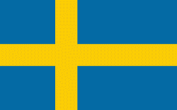
| Flag of Sweden | |
Nature in Sweden is dominated by forests and many lakes, including some of the largest in Europe. Many long rivers run from the Scandes range through the landscape, primarily emptying into the northern tributaries of the Baltic Sea. It has an extensive coastline and most of the population lives near a major body of water. With the country ranging from 55°N to 69°N, the climate of Sweden is diverse due to the length of the country. The usual conditions are mild for the latitudes with a maritime south, continental centre and subarctic north. Snow cover is infrequent in the densely populated south, but reliable in higher latitudes. Furthermore, the rain shadow of the Scandes results in quite dry winters and sunny summers in much of the country.
Currency / Language
| ISO | Currency | Symbol | Significant figures |
|---|---|---|---|
| SEK | Swedish krona | kr | 2 |
| ISO | Language |
|---|---|
| FI | Finnish language |
| SE | Northern Sami |
| SV | Swedish language |


